Quick Answer:
Tsunamis can travel across entire ocean basins, covering thousands of miles from their source. In deep water, a tsunami can move at 500–600 miles per hour, crossing the Pacific Ocean in under a day. Coastal U.S. states like Hawaii, California, Oregon, Washington, and Alaska remain at risk even from tsunamis triggered thousands of miles away.
Understanding How Tsunami Distance Actually Works
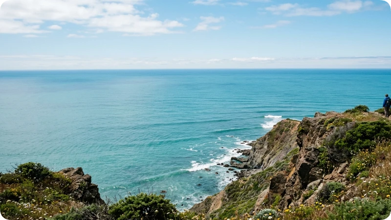
A wave that begins near Japan can strike the beaches of California less than half a day later, which is exactly why “how far do tsunamis travel” matters to anyone visiting a U.S. coastline. Tsunamis aren’t ordinary waves they’re a series of fast moving ocean disturbances triggered by underwater earthquakes, landslides, or volcanic eruptions. Understanding their reach helps travelers plan safer beach trips, choose smarter lodging, and know what warning signs to trust.
Most people picture a tsunami as a single towering wall of water crashing onto a beach. In reality, it’s usually a set of waves that arrive in a sequence, sometimes hours apart, and the first wave is rarely the largest. This guide breaks down exactly how far tsunamis travel, how fast they move, which U.S. destinations face real exposure, and what practical steps keep travelers safe without ruining a coastal vacation.
Can Tsunamis Cross the Atlantic Ocean?
Yes. Although much less common than in the Pacific, tsunamis can cross the Atlantic Ocean if a large enough event occurs. Historical examples include the 1755 Lisbon earthquake and tsunami, which affected Portugal, Spain, Morocco, and produced measurable waves across the Atlantic.
The Atlantic has fewer major subduction zones than the Pacific, making destructive ocean-wide tsunamis much rarer. However, underwater earthquakes, volcanic collapses, and submarine landslides can still generate tsunamis capable of traveling thousands of miles.
For most U.S. travelers, the Pacific Coast, Alaska, and Hawaii remain the areas with the greatest tsunami risk.
How Far Inland Can a Tsunami Travel?
There is no single answer because inland distance depends on the wave’s height, coastal shape, local elevation, and surrounding geography.
In many events, tsunami flooding reaches only a few hundred feet inland. During larger disasters, however, water has traveled several miles inland through low-lying coastal areas, rivers, and estuaries.
Generally:
| Tsunami Size | Possible Inland Reach |
| Small | Hundreds of feet |
| Moderate | Around 0.5–1 mile |
| Major | Several miles in flat coastal terrain |
Rather than focusing on distance alone, emergency officials recommend immediately moving to higher ground whenever a tsunami warning is issued.
Quick Facts About Tsunami Travel Distance
Before diving deeper, here’s a snapshot of the numbers travelers ask about most. These figures come from research published by the National Oceanic and Atmospheric Administration (NOAA) and the National Weather Service Tsunami Warning System.
| Factor | Typical Range |
| Deep ocean travel speed | 500–600 mph (as fast as a jet plane) |
| Nearshore/shallow water speed | 20–30 mph |
| Maximum travel distance | Can cross an entire ocean basin (10,000+ miles) |
| Time to cross the Pacific Ocean | Roughly 20–24 hours |
| Time from a nearby coastal quake to shore | As little as 5–20 minutes |
| Wave height in open ocean | Often under 3 feet (barely noticeable) |
| Wave height near shore | Can exceed 30–100 feet in extreme cases |
How Far Can a Tsunami Actually Travel?
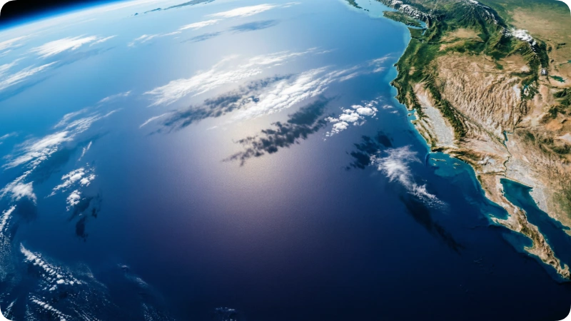
A tsunami can travel across an entire ocean, moving thousands of miles from where it started without losing much energy. Because deep ocean water offers little resistance, the wave’s energy stays intact over enormous distances, unlike wind driven waves that fade quickly. This is why a 2011 Japan triggered tsunami produced measurable wave activity along the California and Oregon coastlines.
The distance a tsunami travels depends on the size of the triggering event, the depth of the ocean it crosses, and the shape of the seafloor along its path. A magnitude 9.0 undersea earthquake can generate a tsunami capable of reaching coastlines on the opposite side of the Pacific. Smaller, localized tsunamis often caused by underwater landslides may only affect nearby shorelines within a few hundred miles.
Why Tsunamis Lose So Little Energy Over Distance
Unlike surface waves created by wind, a tsunami involves the entire water column, from the ocean floor to the surface. This full depth movement means the wave doesn’t dissipate the way normal ocean swells do. It essentially “conserves” its energy across the open ocean, which is the core reason tsunamis are dangerous even to coastlines thousands of miles from the source.
How Long Does a Tsunami Last?
A tsunami is usually not a single wave. Instead, it arrives as a series of waves over several hours.
Important facts include:
- The first wave is often not the largest.
- Dangerous currents may continue for 8 to 24 hours or longer.
- Officials may keep beaches closed long after the initial waves arrive.
This is why emergency managers advise waiting for an official all-clear before returning to the shoreline.
How Fast Do Tsunamis Travel?
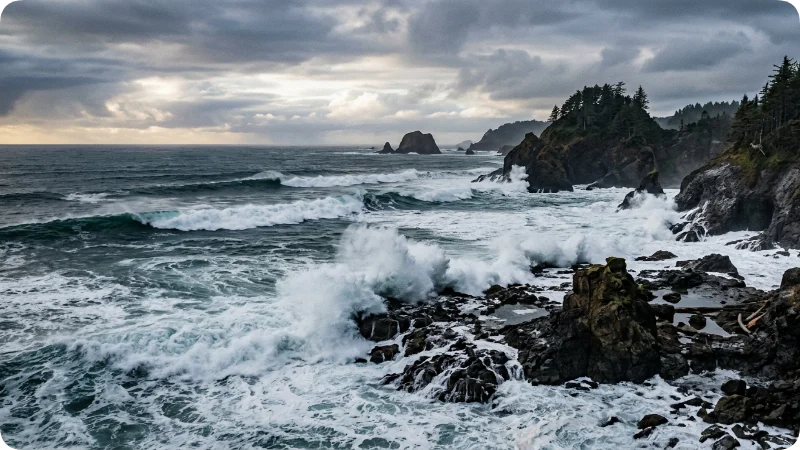
In the open ocean, tsunamis travel between 500 and 600 miles per hour, comparable to the cruising speed of a commercial jet. Speed depends directly on water depth: the deeper the water, the faster the wave moves. As the wave approaches shallower coastal water, it slows dramatically to around 20–30 mph, but that’s when it grows dangerously tall.
This speed to depth relationship explains a critical safety fact: a tsunami generated 3,000 miles away can still arrive faster than most people expect. Travelers relying on visual cues alone waiting to “see” a wave before reacting lose valuable evacuation time.
Nearfield vs. Farfield Tsunamis
- Nearfield (local) tsunamis originate close to the coast, sometimes only minutes from shore. Alaska’s coastal towns and parts of the Pacific Northwest fall into this higher risk category due to the Cascadia Subduction Zone.
- Farfield (distant) tsunamis travel from earthquakes across the ocean, giving coastal areas hours of official warning time through NOAA’s Tsunami Warning Centers.
Can You Outrun a Tsunami?
Not on foot if you’re already at the shoreline.
While tsunamis move relatively slowly near land compared to the open ocean, they still travel much faster than a person can run.
Your best chance is to:
- Evacuate immediately after receiving a warning.
- Move to higher ground.
- Follow marked evacuation routes.
- Never stop to watch or photograph incoming waves.
If you’re already offshore in deep water aboard a properly equipped vessel, captains may receive different guidance from maritime authorities.
Which U.S. Destinations Face the Highest Tsunami Risk?
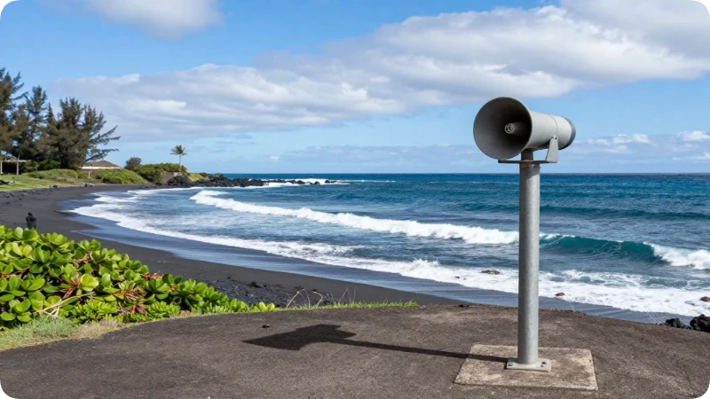
Hawaii, Alaska, California, Oregon, and Washington are the U.S. states with the most documented tsunami exposure, largely due to their position along the Pacific “Ring of Fire.” The Pacific Tsunami Warning Center in Honolulu monitors seismic activity across the Pacific Basin specifically because Hawaii sits directly in the path of both nearfield and farfield waves.
Hawaii
Hawaii has experienced some of the most destructive tsunamis in U.S. history, including events triggered by earthquakes in Alaska and Chile thousands of miles away. Hilo, on the Big Island, has been hit multiple times and now maintains one of the most robust tsunami siren networks in the country.
Alaska
Alaska sits along an active subduction zone, meaning tsunamis here can arrive within minutes of a local earthquake rather than hours. Coastal communities like Kodiak and Sitka maintain evacuation route signage as a standard part of local infrastructure.
California, Oregon & Washington
The Pacific Northwest coastline, including areas near Crescent City, California, and the Oregon Coast, is considered a higher risk zone due to the offshore Cascadia Subduction Zone. Crescent City alone has recorded more tsunami impacts than almost any other town in the continental United States.
Historical Tsunamis That Traveled the Farthest
Several historic tsunamis demonstrate just how far these waves can travel.
| Event | Year | Distance |
| Chile Earthquake | 1960 | Crossed the Pacific to Hawaii and Japan |
| Alaska Earthquake | 1964 | Reached Hawaii and the U.S. West Coast |
| Indian Ocean Tsunami | 2004 | Affected countries across the Indian Ocean |
| Japan Tōhoku Tsunami | 2011 | Crossed the Pacific to North America |
These events show why distant earthquakes are closely monitored even when they occur thousands of miles from U.S. shores.
What Triggers a Tsunami and How Distance Is Determined
Underwater earthquakes cause roughly 80% of tsunamis, with volcanic eruptions and submarine landslides responsible for most of the rest. The size, depth, and type of the triggering event determines how far the resulting waves will travel and how much energy they retain.
- Earthquakes along subduction zones (where one tectonic plate slides beneath another) generate the largest, farthest reaching tsunamis.
- Volcanic eruptions, like the 2022 Hunga Tonga eruption, can send tsunami waves across multiple ocean basins simultaneously.
- Landslides, both underwater and coastal, tend to create more localized but sometimes extremely tall waves.
How Tsunami Warnings Work for Travelers
NOAA’s two Tsunami Warning Centers one in Alaska, one in Hawaii monitor seismic activity 24/7 and can issue alerts within minutes of a qualifying earthquake. Warnings are categorized by urgency, giving travelers a clear framework for how seriously to respond.
| Alert Level | What It Means | Traveler Action |
| Tsunami Warning | Dangerous waves are imminent or occurring | Evacuate immediately to high ground |
| Tsunami Advisory | Strong currents possible, waves less severe | Stay off beaches and out of the water |
| Tsunami Watch | A distant earthquake may generate a tsunami | Monitor local news and be ready to move |
| Information Statement | An earthquake occurred but poses no threat | No action needed |
Hotels and resorts in tsunami prone coastal areas typically post evacuation maps in guest rooms and lobbies; it’s worth a 30 second glance at check in.
Tsunami vs. Regular Ocean Waves
| Feature | Tsunami | Wind Wave |
| Cause | Earthquake, landslide, volcano | Wind |
| Speed | Up to 600 mph | Usually under 40 mph |
| Wavelength | Hundreds of miles | Tens to hundreds of feet |
| Energy | Entire water column | Surface only |
| Distance traveled | Entire oceans | Usually local |
Common Tourist Mistakes About Tsunami Distance and Timing
Many travelers assume they’ll have plenty of visual warning before a tsunami hits, but that assumption has cost lives in the past.
- Mistake: Waiting to see the wave before evacuating. Fix: Treat strong shaking, a sudden ocean pullback, or an official alert as your signal to move immediately don’t wait for visual confirmation.
- Mistake: Assuming a tsunami only affects the exact area where the earthquake happened. Fix: Remember that tsunamis can travel thousands of miles, affecting coastlines far from the epicenter.
- Mistake: Returning to the beach after the first wave passes. Fix: Tsunamis arrive in a series; later waves are often larger than the first. Wait for an official “all clear.”
Insider Safety Tips for Coastal Travelers
- Check evacuation signage on arrival. Coastal hotels in Hawaii, Alaska, and the Pacific Northwest post blue and white tsunami evacuation route signs; note the nearest one within your first hour at a destination.
- Download NOAA’s alerts before you travel, since cell service can be unreliable during major seismic events.
- Learn the natural warning signs: a sudden, unusual withdrawal of the ocean, a loud roaring sound from the sea, or strong, prolonged ground shaking near the coast.
- Ask your hotel about elevation. Properties built above 100 feet in elevation, or a mile or more inland, generally sit outside typical tsunami inundation zones.
- Keep a small “go bag” with your passport, phone charger, and medication if you’re staying in a known high risk coastal zone like Crescent City or Hilo.
Tsunami Travel Safety Checklist
Before visiting a tsunami-prone destination:
- Check NOAA tsunami alerts.
- Learn your hotel’s evacuation route.
- Identify nearby high ground.
- Enable emergency alerts on your phone.
- Pack comfortable walking shoes.
- Keep medications and ID easily accessible.
- Avoid beaches during tsunami advisories.
- Wait for the official all-clear before returning.
Hidden Gems: Safer Coastal Alternatives With Great Views
Travelers who want ocean scenery with lower tsunami exposure have solid options along the U.S. coastline.
- Cannon Beach, Oregon’s elevated viewpoints, such as Ecola State Park, offer sweeping coastal views from higher ground away from immediate inundation zones.
- Diamond Head Lookout, Oahu, provides a panoramic Pacific view from a volcanic crater rim well above sea level.
- Cape Flattery, Washington, sits on elevated coastal bluffs in the northwest corner of the continental U.S., offering dramatic ocean views with more natural elevation buffer than beach level spots.
Is Tsunami Risk a Reason to Avoid Coastal Travel?
Tsunami risk should inform your planning, not cancel your trip. Destructive tsunamis affecting U.S. shores are rare events, and warning systems today give most travelers meaningful lead time. The real risk factor isn’t the ocean it’s being uninformed about evacuation routes and warning signs.
Who should take extra precaution: Travelers staying directly on the beach in Hawaii, coastal Alaska, or Crescent City, California, especially during peak earthquake activity in the Pacific region.
Who can relax more: Visitors staying inland or at elevation, or in destinations along the U.S. Atlantic or Gulf Coasts, where tsunami risk is historically much lower due to different tectonic conditions.
Packing and Planning Advice for Tsunami Prone Coastal Trips
Pack light, practical items that support quick evacuation rather than slow you down.
- Comfortable, closed toe walking shoes (not flip flops) for a fast uphill evacuation if needed
- A portable phone charger for accessing NOAA alerts
- A printed copy of your hotel’s evacuation map, since digital access may fail during an event
- A small physical flashlight, useful if evacuation happens at night or during a power outage
Family and Accessibility Considerations
Traveling with young children or family members with mobility challenges calls for a bit of extra planning in tsunami zones. Choose accommodations on higher floors or elevated ground when possible, and walk the evacuation route once during daylight so it’s familiar if needed at night. Ask front desk staff directly about accessible evacuation routes, since standard tsunami escape paths often involve stairs or steep terrain.
Keep children within arm’s reach during an evacuation.
Choose accommodations outside mapped inundation zones when possible.
If traveling with elderly family members, ask hotels about accessible evacuation transportation.
Practice the evacuation route once after checking in.
Responsible Travel Note
If you experience a tsunami warning during your trip, prioritize following official guidance from NOAA, local emergency management, or hotel staff over social media reports, which can spread outdated or inaccurate information during fast moving events. Local tourism boards, including the Hawaii Emergency Management Agency, publish verified updates during active warnings.
Never enter restricted shoreline areas after a tsunami warning simply to take photographs.
Avoid interfering with emergency responders.
Respect beach closures even if conditions appear calm.
Follow local authorities rather than social media rumors.
FAQs
How far can a tsunami travel from its origin?
A tsunami can travel across an entire ocean basin, covering more than 10,000 miles while retaining much of its original energy. This is why an earthquake near Japan or Chile can still generate measurable wave activity along U.S. Pacific coastlines.
How fast does a tsunami travel across the ocean?
In deep water, tsunamis typically move between 500 and 600 miles per hour. As they reach shallower coastal waters, they slow to roughly 20–30 mph while growing significantly in height.
Can a tsunami reach the East Coast of the United States?
Tsunamis are far less common in the U.S. East Coast due to fewer nearby subduction zones, though they aren’t impossible; underwater landslides or a rare distant event could theoretically generate one. The Pacific Coast, Alaska, and Hawaii carry significantly higher documented risk.
How much warning time do coastal travelers usually get?
Warning time ranges from just minutes for nearfield tsunamis near Alaska or the Pacific Northwest to several hours for farfield tsunamis crossing the Pacific from distant earthquakes. NOAA’s warning centers issue alerts as quickly as seismic data allows.
Do all earthquakes cause tsunamis?
No, only certain underwater earthquakes generate tsunamis, typically those that cause vertical seafloor displacement along subduction zones. Most tsunamis result from large earthquakes measuring magnitude 7.0 or higher.
What should I do if I’m on the beach during a tsunami warning?
Move immediately to higher ground or at least a mile inland, without waiting to see the wave first. Follow posted evacuation route signage or hotel staff instructions rather than trying to drive, since roads can become congested quickly.
Is it safe to visit Hawaii or coastal Alaska despite tsunami risk?
Yes, millions of travelers visit these destinations safely every year, and modern warning systems provide meaningful lead time for most events. Staying informed about evacuation routes turns a low probability risk into a manageable one.
Can a tsunami travel around islands?
Yes. Waves can wrap around islands through wave refraction, meaning areas not directly facing the earthquake may still experience dangerous currents and flooding.
Do tsunamis lose strength over time?
They gradually lose energy, but far more slowly than ordinary ocean waves. Large tsunamis can remain dangerous after traveling thousands of miles across deep oceans.
Can lakes have tsunamis?
Yes. Earthquakes, landslides, glacier collapses, and volcanic activity can produce tsunami-like waves in lakes, though they are usually called seiches or inland tsunamis.
What is the largest tsunami ever recorded?
The 1958 Lituya Bay event in Alaska produced a 1,720-foot megatsunami caused by a massive landslide. It was the tallest wave ever recorded but remained localized rather than crossing an ocean.
Which U.S. national parks have tsunami hazards?
Parks such as Olympic National Park (Washington), Kenai Fjords National Park (Alaska), and parts of Hawaii Volcanoes National Park include coastal areas where tsunami awareness is important.
Final Takeaways
Tsunamis can travel thousands of miles across entire ocean basins, moving as fast as a jet plane in deep water before slowing and growing near shore. U.S. destinations like Hawaii, Alaska, California, and the Pacific Northwest carry the highest documented risk, but robust NOAA warning systems and simple preparation knowing evacuation routes, recognizing natural warning signs, and reacting quickly make coastal travel manageable rather than something to fear.
The ocean’s power is part of what makes these coastlines so unforgettable to visit in the first place. A little preparation lets travelers enjoy Hawaii’s shores, Alaska’s fjords, and the Pacific Northwest’s dramatic coastlines with confidence rather than worry.
Tsunami risk levels, warning systems, and evacuation guidance can change. Always verify current conditions through NOAA’s National Weather Service Tsunami Warning System and local emergency management resources before and during coastal travel.

Gordon Ramsay is a travel writer and destination researcher who helps U.S. travelers plan smarter trips, covering destinations, seasonal trends, budgets, and logistics to help readers decide where—and when—to go.
Rather than simply listing popular places, Gordon Ramsay focuses on what travelers actually need: comparing weather against crowds, weighing costs and accessibility, and researching current conditions alongside official tourism guidance—delivering honest, practical advice without the hype.