Featured Snippet: A good New York tourist map combines subway routes, walking distances, and borough layouts so you can move between attractions without wasting time. The best options mix a digital app like Google Maps or Citymapper with a free paper subway map from any MTA station, since phone batteries die and underground service drops out.
New York City can swallow a first time visitor whole. Streets curve where you don’t expect them, subway lines split into local and express trains, and five boroughs stretch across more space than most vacation planners realize. Without a solid map, you’ll burn hours just figuring out which way is uptown.
That’s the real cost of skipping this step. Not missing a landmark, but losing daylight hours you could have spent inside the Met or walking the High Line. A smart tourist map strategy fixes that before you even land at JFK or LaGuardia.
This guide breaks down every map type worth carrying, where to find them free, how to read the subway system without panicking, and which neighborhoods rarely make it onto the standard tourist handout. If you’re planning a three day sprint through Manhattan or a slower trip that includes Brooklyn and Queens, you’ll leave this page knowing exactly how to get around.
Quick Facts: New York Tourist Maps at a Glance
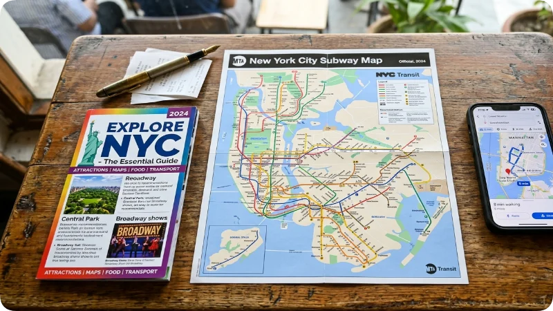
| Map Type | Best For | Cost | Where to Get It |
| MTA Subway Map | Train navigation | Free | Any subway station booth |
| Google Maps App | Walking + transit directions | Free | App store |
| Citymapper App | Real time subway alerts | Free | App store |
| NYC & Company Visitor Map | Attraction overview | Free | Times Square Visitor Center |
| Paper Borough Maps | Offline backup | Free–$5 | Visitor centers, hotels |
| Central Park Map | Park navigation | Free | Park entrances, app |
Prices and hours for attractions change often. Always confirm current details on official sites like nps.gov or nyc.gov before you finalize plans.
Why a Good Map Matters More in New York Than Almost Anywhere Else
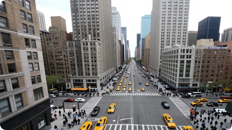
New York isn’t laid out like most American cities. Manhattan follows a grid above 14th Street, but everything below that point twists into old colonial era streets that ignore the grid entirely. Add four more boroughs, each with its own street logic, and it’s easy to see why tourists get turned around.
A reliable map does more than point you toward attractions. It tells you which subway line actually stops near your hotel, how far a “quick walk” really is, and where neighborhoods blend into each other without clear signage. Skipping this step usually means wasted subway swipes, missed reservations, and a lot more walking than planned.
Callout: Even locals use apps daily. There’s no shame in checking your phone on a Manhattan sidewalk everyone does it.
Types of New York Tourist Maps You’ll Actually Use
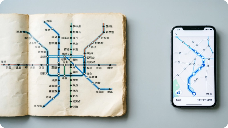
Different situations call for different maps, and relying on just one usually leaves a gap somewhere in your trip.
Digital apps work best for real time directions, live subway delays, and walking routes between stops. Paper subway maps matter as backup when your phone dies or you’re underground without signal. Neighborhood or borough maps help you understand what’s actually walkable versus what needs a train. Printed attraction maps from museums and parks add detail that general apps skip, like which entrance is closest to a specific exhibit.
Carrying at least two types one digital, one paper covers you in almost every situation New York throws at you.
Where Can You Get a Free New York Tourist Map?
You can find free New York maps in several places, including subway stations, hotels, visitor centers, museums, and major attractions. The MTA subway map is especially useful for understanding the city’s transit network, while neighborhood maps are better for planning walking routes.
For most first-time visitors, the best combination is a free paper subway map plus a digital map app.
Useful free map options include:
- MTA subway map for train routes
- NYC visitor maps for major attractions
- Central Park maps for trails and landmarks
- Hotel neighborhood maps
- Offline digital maps for walking directions
Availability can vary, so don’t assume every location will have printed tourist maps in stock.
Can You Download a New York Tourist Map PDF?
Yes. Travelers can save digital maps to their phones before leaving home, which is especially useful when subway service is disrupted or mobile connectivity is limited.
For transit, use the most current official MTA map available. For sightseeing, an offline map of the neighborhoods you’ll visit can be more useful than downloading a giant city map.
Before your trip:
- Save your hotel location.
- Download offline map areas.
- Save major attractions.
- Screenshot important routes.
- Keep a paper subway map as backup.
Avoid relying on an old PDF from an unofficial travel website because subway routes, entrances, and service information can change.
New York Tourist Map With Attractions
A tourist map becomes more useful when attractions are grouped by location rather than viewed as one long checklist.
Midtown
- Times Square
- Rockefeller Center
- Empire State Building
- Broadway
Upper Manhattan
- Central Park
- Metropolitan Museum of Art
- American Museum of Natural History
- The Cloisters
Lower Manhattan
- 9/11 Memorial
- Wall Street
- Battery Park
- Statue of Liberty ferry connections
Brooklyn
- Brooklyn Bridge Park
- DUMBO
- Brooklyn Heights
- Prospect Park
Queens
- Flushing Meadows Corona Park
- Flushing
- Jackson Heights
Best Digital Map Apps for Exploring NYC
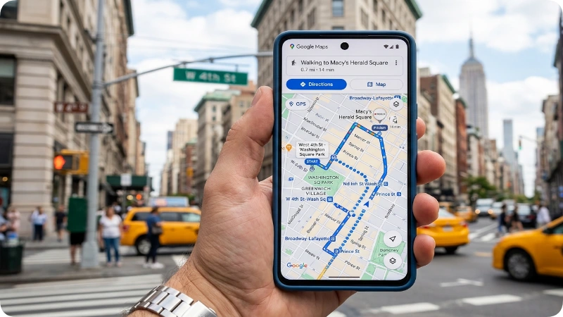
Google Maps remains the default choice, and for good reason. It layers walking directions, subway routes, and estimated travel times into one screen, and it works offline if you download the Manhattan map area in advance.
Citymapper often edges it out for subway specific navigation. It shows which subway car to board for the closest exit at your destination station, a small detail that saves real time during rush hour. TrainTime is associated primarily with Long Island Rail Road and Metro-North commuter rail, not the NYC subway system., which helps when you’re standing on a platform wondering if the next train is two minutes or twenty away.
For walking heavy days, AllTrails covers Central Park’s loop paths, while the NYC Parks app maps smaller green spaces most tourist guides skip entirely, like Fort Tryon Park near the Cloisters.
Tip: Download your route area in Google Maps before you leave your hotel. Subway tunnels kill cell signal fast, and you don’t want to be stuck without directions between stops.
How to Read the NYC Subway Map Without Losing Your Mind
The subway map looks intimidating at first, but the logic is simpler than it appears. Each colored line represents a route, and most lines run both local (stopping at every station) and express (skipping smaller stations) service on the same track.
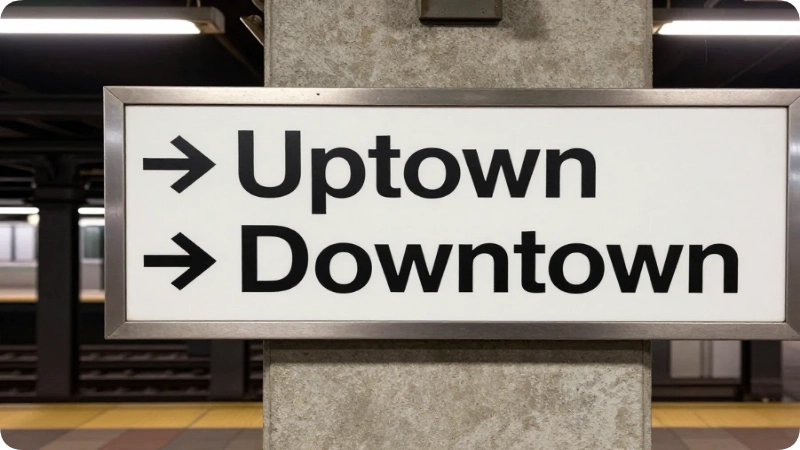
Numbers and letters mark specific trains the 4, 5, and 6 run express and local versions along the same East Side corridor, for example. Uptown means north, downtown means south, and that distinction matters more than which specific train you board, since boarding the right train going the wrong direction is the single most common tourist mistake.
Free paper copies sit in racks at every station booth, and station attendants will usually help if you’re stuck. The MTA also posts current maps and service alerts at new.mta.info, which is worth checking the morning of any trip since weekend service changes happen often.
Common Subway Mistakes and How to Avoid Them
- Boarding the wrong direction. Double check the platform sign for uptown/downtown before swiping in.
- Missing express stops. If your stop isn’t listed on an express train’s station list, wait for a local.
- Confusing similar station names. “86th Street” exists on multiple lines in different neighborhoods to verify the line letter or number, not just the street name.
How to Use the NYC Subway Map
Step 1: Find your current location.
Step 2: Find your destination station.
Step 3: Identify the subway line connecting the two.
Step 4: Check whether you need an uptown or downtown train.
Step 5: Confirm whether the train is local or express.
Step 6: Check the station name before leaving the train.
Example
If you’re in Midtown and heading north toward the Upper West Side, check the subway line, direction, and destination station before boarding. Don’t rely only on the street number because NYC has multiple stations with similar names.
Where to Get Free Paper Maps in NYC
Paper maps still matter, even in a smartphone saturated city. Free MTA subway maps are commonly available at subway stations, although availability can vary and most hotel concierge desks keep a stack of borough and neighborhood maps for guests.
The NYC Information Center in Times Square (at Seventh Avenue and 43rd Street) hands out visitor maps covering major attractions, along with staff who answer questions in multiple languages. Visitor centers also operate in Chinatown, Harlem, and near Grand Central Terminal, each stocking neighborhood specific handouts that general tourist maps often skip.
Museums and parks distribute their own detailed maps at entrances; the Central Park map available at any park entrance shows far more trail detail than what shows up on a general city map.
New York Tourist Map by Neighborhood
Planning your NYC trip by neighborhood is often easier than planning it attraction by attraction. Instead of crossing the city several times a day, group nearby sights together.
| Neighborhood | Best For |
| Midtown | Broadway, Times Square, Rockefeller Center |
| Upper West Side | Central Park, museums, restaurants |
| Upper East Side | The Met, Central Park |
| SoHo | Shopping, architecture |
| Greenwich Village | Cafés, historic streets |
| Lower Manhattan | 9/11 Memorial, Wall Street |
| DUMBO | Brooklyn Bridge views |
| Williamsburg | Food, shopping, nightlife |
| Flushing | Food and cultural experiences |
| Harlem | History, music, culture |
Simple rule: If two attractions are only a few blocks apart, put them on the same sightseeing day.
This section makes the article significantly more useful.
Top Attractions Mapped by Borough
Most visitors stick to Manhattan, but New York’s other boroughs hold plenty worth the extra subway ride.
Manhattan
This is where most first time visitors spend the bulk of their trip. Times Square, the Empire State Building, Central Park, the Metropolitan Museum of Art, and the 9/11 Memorial all sit within Manhattan’s grid, connected by subway lines that run frequently throughout the day.
Brooklyn
DUMBO’s cobblestone streets offer some of the best skyline photo angles in the city, especially near the Brooklyn Bridge Park waterfront. Williamsburg draws visitors interested in food and street art, while Prospect Park gives a quieter, less crowded alternative to Central Park. Brooklyn also covers a large area, so DUMBO, Prospect Park, and Williamsburg are better treated as separate neighborhood stops rather than one walking route.
Queens
Flushing Meadows Corona Park holds the Unisphere and the site of two former World’s Fairs. Queens also claims some of the city’s most diverse food scenes Jackson Heights and Flushing both reward visitors willing to skip the subway map’s more obvious stops. Queens is geographically large, so attractions that look close together on a citywide map can require significant subway travel. Check the route between stops before combining multiple Queens neighborhoods in one day.
The Bronx
The Bronx Zoo and New York Botanical Garden anchor most visitor itineraries here, both reachable by subway and worth a half day trip if wildlife or gardens interest you. Because major attractions are spread farther apart, plan Bronx sightseeing around one main area rather than trying to cover the borough in a single afternoon.
Staten Island
The Staten Island Ferry is a free public ferry connecting Lower Manhattan and Staten Island, with views of New York Harbor and the Statue of Liberty.
Hidden Gems Most Tourist Maps Skip
Standard visitor maps push the same dozen landmarks, but a few spots rarely make the cut despite being genuinely worth the trip.
- The Elevated Acre a small, quiet park near the Financial District with harbor views and almost no crowds, even in peak season.
- Green-Wood Cemetery in Brooklyn historic, sculpture filled grounds with skyline views that rival more famous lookout points.
- The Cloisters a medieval art branch of the Met, tucked into Fort Tryon Park at Manhattan’s northern tip, often overlooked simply because of the subway ride required to reach it.
These spots reward travelers willing to step outside the standard tourist map radius, usually with far smaller crowds as the payoff.
Day 3 – Choose One Borough
Brooklyn option: Start in DUMBO, walk through Brooklyn Bridge Park and Brooklyn Heights, then head to Williamsburg for dinner.
Queens option: Visit Flushing Meadows Corona Park, then continue to Flushing for a food-focused afternoon and evening.
A map only helps if you actually plan a route with it. Here’s a practical structure for a first NYC visit.
Day 1 – Midtown and Central Park: Start at Rockefeller Center, walk north through Central Park, then head to the Met. All three sit within reasonable walking distance of each other.
Day 2 – Downtown and Brooklyn: Visit the 9/11 Memorial, walk the Brooklyn Bridge, and explore DUMBO before catching the subway back to Manhattan for dinner.
Day 3 – A Borough Beyond Manhattan: Pick either Brooklyn’s Prospect Park area or Queens’ Flushing Meadows, both accessible by subway and light on tourist crowds compared to Manhattan’s core.
Spacing attractions by neighborhood rather than jumping across the city saves hours of backtracking.
Common Tourist Mapping Mistakes (And How to Fix Them)
Mistake 1: Trying to see everything in one day. New York rewards a slower pace. Group attractions by neighborhood instead of chasing every landmark on one map.
Mistake 2: Ignoring walking distances. A map can make two points look close when they’re actually a 25 minute walk apart. Check estimated walking time, not just the visual distance.
Mistake 3: Relying only on a phone. Battery drains fast in cold weather, and underground subway stations often have no signal. Carry a backup paper map for at least your main travel day.
Getting Around: Transportation Options Beyond the Subway
The subway covers most of the city, but it isn’t the only option. Buses reach areas the subway skips, particularly useful in outer Brooklyn and Queens neighborhoods. The Staten Island Ferry is free and doubles as a scenic harbor tour. Citi Bike, the city’s bike share program, works well for shorter trips through flatter neighborhoods like the Lower East Side or Williamsburg.
Yellow cabs and rideshare apps fill gaps late at night when subway service slows, though traffic during rush hour often makes walking or the subway faster across Manhattan.
Walking Tours and Neighborhood Maps
Self guided walking tours give a closer look at neighborhoods than a subway ride ever could. The High Line, an elevated park built on old rail tracks, offers its own map at each entrance point along Manhattan’s West Side. Free walking tour maps covering Greenwich Village, SoHo, and Harlem are available at most visitor centers and give historical context that general tourist maps leave out.
Accessibility Maps and Resources
Travelers with mobility needs should know that not every subway station has elevator access. The MTA publishes an Accessible Stations map at new.mta.info that shows exactly which stations offer elevators and ramps, since guessing wrong can mean a long detour to the next accessible stop.
Major museums and attractions typically post accessibility details on their official websites, including wheelchair rental availability and accessible entrances worth checking the day before a visit rather than discovering an issue on arrival.
Before Taking an Accessible Subway Route
Check:
- Whether the station has an elevator
- Which entrance has elevator access
- Whether the elevator is currently working
- Accessible transfer options
- Walking distance from the accessible entrance
- Planned service changes
This is especially important because not every entrance to an accessible station necessarily provides the same access.
What to Do If You Get Lost in NYC
Getting turned around in New York is normal, especially below 14th Street or when changing subway lines.
If your directions stop making sense:
- Step into a café, hotel lobby, or station entrance.
- Check your route before continuing.
- Confirm the street and avenue you’re on.
- Save your hotel address offline.
- Keep your phone charged.
- Carry a paper subway map.
- Don’t be afraid to ask a station employee for help.
A five-minute reset is better than walking 20 minutes in the wrong direction.
Safety Tips While Navigating New York with a Map
Keep your phone and paper map out during the day without hesitation checking directions openly is completely normal in New York and doesn’t draw unwanted attention. At night, stick to well lit, busier streets when possible, and consider downloading offline maps in case you lose signal in less familiar areas.
Standard city safety practices apply here just like anywhere else: stay aware of your surroundings, keep valuables secure, and trust your instincts if a street feels off limits after dark.
Family Friendly Mapping Tips
Traveling with kids works better when you build in shorter walking stretches and known rest points. Central Park’s map marks several playgrounds along common walking routes, useful for breaking up a long day of sightseeing. Choosing a hotel near a major subway hub cuts down on long walks with tired children at the end of the day.
Solo Traveler Tips
Solo travelers benefit from sticking to well marked tourist routes during the first day or two while getting oriented. Sharing your daily route with someone back home, even just a rough outline, adds a layer of safety without complicating your plans. Popular neighborhoods like Midtown and the Upper West Side tend to feel comfortable for solo exploration, even after dark.
Budget Saving Tips Using Your Map
Grouping attractions by neighborhood can save both time and transportation costs. Walking between nearby attractions is often more efficient than taking the subway for short distances.
For subway and bus travel, check the MTA’s current fare and payment options before your trip. The city’s payment system has moved beyond the traditional MetroCard, so visitors should confirm the latest fares, fare-capping rules, and payment methods before arriving.
Many museums offer pay what you wish hours on certain days the Met and several others post these schedules on their official sites, and mapping your visit around them can cut costs significantly.
Best Photo Spots Along Common Map Routes
A few spots consistently deliver strong photos without requiring a detour from typical routes: the DUMBO cobblestone street framing the Manhattan Bridge, the Top of the Rock observation deck for a skyline that includes the Empire State Building itself, and Brooklyn Bridge Park’s waterfront for classic skyline shots at sunset. Early morning visits to any of these cut down on crowds significantly.
FAQs
Is there a free tourist map of New York City?
Yes. Free maps are available at every subway station booth, the NYC Information Center in Times Square, most hotel front desks, and official visitor centers throughout the city. Digital options like Google Maps are also free to download.
What’s the best app for navigating the NYC subway?
Citymapper and Google Maps both handle subway navigation well, offering real time arrival times and step by step transfer directions. For subway-specific service information, use the MTA’s current subway tools and service alerts. These can help you check planned changes, delays, and disruptions before and during your trip.
Do I need a paper map if I have a smartphone?
A paper map is a smart backup. Phone batteries drain quickly in cold weather, and subway tunnels often block cell signals, so having a physical map prevents getting stuck without directions.
How far apart are New York’s major attractions?
Distances vary widely. Some Midtown attractions sit within a 10 minute walk of each other, while others, like the Bronx Zoo, require a 30–45 minute subway ride from central Manhattan. Always check walking time on a map before assuming two points are close.
Is there a New York tourist map with attractions?
Yes. Tourist maps commonly highlight major attractions, neighborhoods, transportation routes, and landmarks. Digital maps are especially useful because they can combine attractions with walking and subway directions.
What is the best New York tourist map for first-time visitors?
For most first-time visitors, the best combination is a digital navigation app and a paper MTA subway map. Use the app for detailed directions and the paper map for understanding the overall subway system.
Can I download a New York tourist map before my trip?
Yes. Download offline maps, save your hotel and major attractions, and keep a current subway map available before you arrive. This provides a backup if your phone loses signal or battery.
Which New York neighborhoods are walkable without a map?
Manhattan’s grid above 14th Street is fairly easy to navigate without heavy map reliance, since streets and avenues run in predictable numbered order. Below 14th Street and in most other boroughs, a map helps significantly more.
Is the NYC subway map hard to read for first time visitors?
It looks complicated at first, but focusing on just your specific line and direction (uptown or downtown) simplifies it quickly. Station booth attendants are usually willing to help if you’re unsure.
Where can I get a Central Park specific map?
Central Park maps are available at any of the park’s entrances and through the NYC Parks app, showing trails, playgrounds, and landmarks in more detail than a general city map provides.
Final Takeaways
A great New York trip depends less on which attractions you pick and more on how efficiently you move between them. Carry both a digital app and a paper backup, group your sightseeing by neighborhood instead of jumping across the map, and don’t be afraid to explore a borough beyond Manhattan.
New York rewards travelers who plan their route with intention. Before your trip, download an offline map of the areas you’ll visit most, and grab a physical subway map from any station once you land that single step will save you more time than almost anything else on this list.